To support readiness and response to Hurricane Ian, the IAFC is curating the most relevant and authoritative situational awareness resources for use by leaders in the fire and emergency services. This page will be updated with new resources as the incident evolves.
To nominate a Hurricane Ian situational awareness resource to the IAFC library please complete the form below.
Submit a resource
FEMA Geospatial Resource Center
 FEMA supports the emergency management community with world-class situational awareness information, geospatial services, and technologies to prepare for, protect against, respond to, recover from and mitigate against all hazards. Access FEMA's GIS Hub.
NOAA Hurricane Forecasts and Advisories
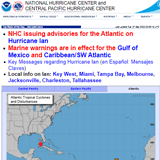 NOAA’s National Hurricane Center – For the most authoritative source for Hurricane Advisories visit the NHC website.
PhotoMappers
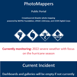 The PhotoMappers team is now collecting valuable situational awareness photos of Hurricane Ian. The PhotoMappers site was created to support the use of apps, maps, and data from the Disaster Crowdsourced Photo initiative. Understanding the initial impacts of disasters can be very challenging, especially without geographic context. NAPSG Foundation (along with URISA's GISCorp) hosts a volunteer-powered platform for quickly finding, mapping, and sharing the location of photos found in news stories and social media platforms. Both public safety agencies and the public can gain situational awareness when photos are placed on the map.
Esri Disaster Response Program
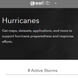 Esri’s Disaster Response Program (DRP) assists organizations responding to disasters or crises worldwide as part of their corporate citizenship. The DRP supports response efforts with GIS technology and disaster response expertise when an organization’s capacity is exceeded. Their Hurricane Page provides maps, datasets, applications, and more to support hurricane preparedness and response efforts.
SARCOP
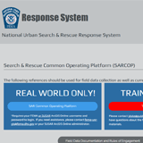 The IAFC continues to support state and local Search & Rescue Teams through our work with the SAR Common Operational Picture (COP) Tool for Search & Rescue Teams. Launched in 2016, SARCOP is a cornerstone for collaborative response to disasters where SLTT assets share near real-time data during response operations. The IAFC along with its partners National Alliance for Public Safety GIS (NAPSG) Foundation and ESRI, manage and maintain the SARCOP as a national response support tool. For more information visit the SARCOP webpage.
Questions about the tools or the SARCOP can be sent to GISPrograms@iafc.org
HIFLD Open Data
 Access nearly 400 geospatial data layers for our nation’s key infrastructure through the HIFLD Open website hosted by the US Department of Homeland Security (DHS) in collaboration with the National Geospatial-Intelligence Agency (NGA). Publicly accessible infrastructure data can be used to support basic planning and situational awareness for mutual aid resources for all types of disasters, including hurricanes.
Florida Hurricane Ian GIS Resources
 Florida Division of Emergency Management makes several key resources available to support disaster readiness and response efforts.
Georgia Emergency Management & Homeland Security Agency
 Georgia makes several key resources available to support disaster readiness and response efforts.
South Carolina Hurricane Situational Awareness Resources
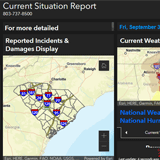 South Carolina Emergency Management Division (SCEMD) makes key situational awareness resources available to support disaster readiness and response.
Virginia Department of Emergency Management
 Virginia Department of Emergency Management (VDEM) situational awareness resources provide disaster response and recovery support.